Broadway Avenue
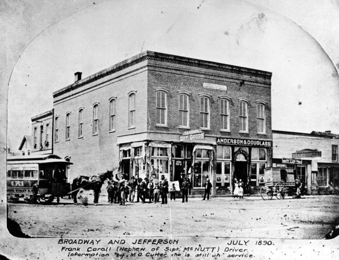
FORT WAYNE HISTORY. THE CORNER OF BROADWAY AND JEFFERSON IN JULY 1890 on the Allen County Public Library Digital Collections at the Allen County Public Library.
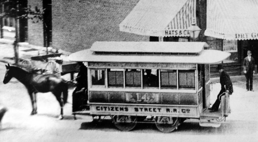
Frank Caroll (Nephew of Supt. McNutt) Drive. Informatoin by M. O. Cutter who is still in service.
Discussed February 25, 2025 on True Fort Wayne Indiana History on Facebook. Randy Harter comment shows it is the northwest corner in 2025 a playground Street View on Google Maps. A different April 2, 2025 discussion of a 1870s stereographic photo.
Citizens Street Railroad Company: showing horse-drawn trolley at corner of Jefferson and Broadway, Fort Wayne, ca. 1887. These vehicles were in use 1872-1892. Sign on side says 'Garden St. & Glasgow Ave.'on the Allen County Public Library Digital Collections at the Allen County Public Library.
June 8, 2023 post by ARCH, Inc. on Facebook:
Drive south on Broadway Avenue and you will find this wonderful example of an unaltered 19th century Queen Anne/Neoclassical Commercial building, circa 1890. The building still has the original storefront windows, doors and recessed oriels. Most windows have flat arched bonded brick and stone sills. The roof features a stepped brick parapet with stone coping, brick chimneys and projecting wood cornice. A modern cloth awning and lights have been installed along the front, beneath the wood frieze and projecting cornice. It was once the drugstore of Carole Lombard’s uncle. As a child, Lombard liked to visit and drink a soda. It has housed many different businesses, including Chappell’s Seafood Market and Coral Grill restaurant, and currently is home of Trubble Brewing. ARCH is proud to present this edition of Throwback Thursday, part of its work as the historic preservation organization serving the greater Fort Wayne area, made possible by ARCH members and donors. Thank you.
Shared June 8, 2023 on True Fort Wayne Indiana History on Facebook stating:
Besides the Coca-Cola ghost sign, there's a sign that marks this as Otto Peters' drugstore. A very cool building, formerly at the corner of Broadway and Beaver. The corner has been replaced by the plaza. The building still stands.
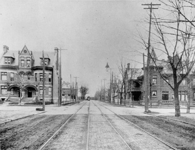
Broadway to Wayne Street, circa 1900.. BAKER191a Description: Photo taken from middle of Broadway towards Wayne. Theodore Frank house (704 West Wayne) on the left and Ely Hoffman house (624 West Wayne) on right. in the Allen County Public Library Digital Collections at the Allen County Public Library. Photo shows trolley tracks.
Photo discussed February 20, 2024 on True Fort Wayne Indiana History on Facebook.
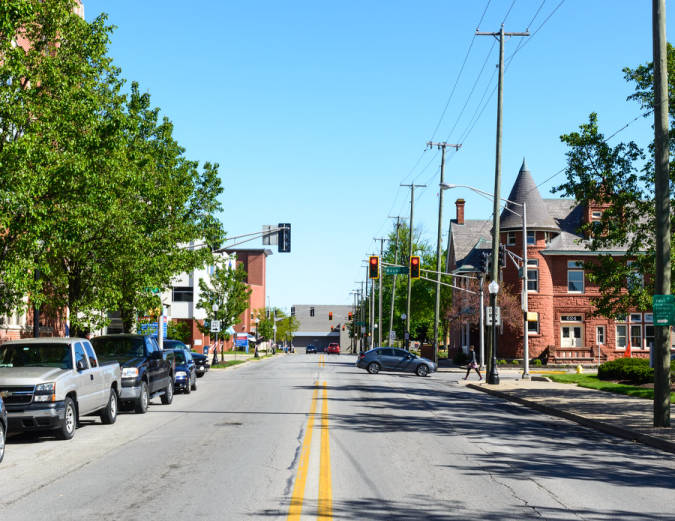
Broadway to Wayne Street, 2017. BAKER191b Description: Photo taken from middle of Broadway towards Wayne. Ely Hoffman House (624 West Wayne) on the right; Broadway Christian Church along the left. in the Allen County Public Library Digital Collections at the Allen County Public Library.
Current Street View from Google Maps